# tlohde

Salliarutsip Sermia

A simple black and white map with very few features. A single line of longitude at 52°30′ W and one line of latitude at  72°0′ N cross the image. Just north east of their intersection is the text: 'The marine-terminating Salliarutsip Sermia retreated 12 km between 2000 and 2025'. This text is written over two lines; is aligned south-west to north-east and has a gentle curve to it. At either end of the text are two thick black lines, each slightly curved and jagged, representing the terminus positions of the glacier. The credits in the bottom left read: 'by:tlohde / terminus positions digitized from Landsat 7 & 8 acquisitions on 26/8/2000 and 23/8/2025'
Salliarutsip Sermia: Like many tidewater glaciers: Salliarutsip Sermia, West Greenland, has undergone substantial terminus retreat in recent years. This was made for Day 11 of the 2025 #30DayMapChallenge: Minimal

projection NSIDC Sea Ice Polar Stereographic North. EPSG:3413
tools QGIS for digitizing and measuring retreat; Inkscape for making it look nice
data Landsat 7 scene: 26/8/2000 Landsat 8 scene: 23/8/2025
font Noto Sans Mono
comments 
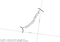
Why highlight Salliarutsip Sermia? Because Jakobshavn Isbræ needs to learn to share the spotlight. I like this, but I suspect only those who already know what they're looking at are able to interpet it. Either drawing the fjord walls, or adding a few more labels (ice sheet; ocean) would help. Also, on more graticule line, either lat or long to help with the lack of scalebar (in case main text isn't enough to indicate that the distance between the two lines is 12 km). I'd quite like to make a series of these, but not sure how I'd represent those on the east coast where retreat marches westwards, and the text direction would be contradicting the retreat direction.
date 11/11/2025