Memory Lanes
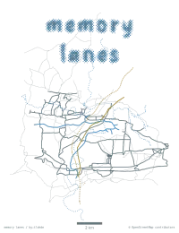
| projection | OSGB |
|---|---|
| tools | QGIS for drawing; python matplotlib for final plotting both drawn and actual data
|
| data | OpenStreetMap contributors |
| font | Pao Halftone by Wahyu Eka Prasetya |
| comments | I really like this one, and the associated graphs; a legend would be improve things. Somewhat pleasingly / accidently, I exported this with a transparent background, but because the colours used in the map, and on this site are from Ethan Schoonover's Solarized, this map works if you toggle between light and dark mode. |
| date | 23/11/2024 |