| projection |
Stereographic: central longitude: 45W, central latitude: 90N, true scale latitude: 70N
|
| tools |
python: geopandas, matplotlib, shapely, KDTree() from scipy.stats, osmnx
|
| data |
Arctic DEM v4.1 (Porter et al., 2023); OpenStreetMap contributors
|
| font |
Magenta Flow by Chequered Ink
|
| comments |
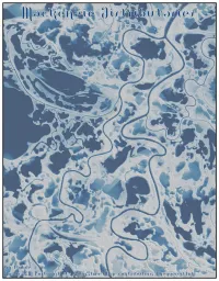
Tried using the RiverREM package, but found more success following/adapting this tutorial. I suspect the 2 m resolution of ArcticDEM isn't perhaps high enough res for a good REM; and there's not much in the way of slope across this domain, so not a lot of elevation to de-trend; ~7 km across and ~10 km tall—probably should have included a scalebar; the typeface is nice, and suits the theme, but it is wholly unreadable
|
| date |
06/11/2024
|